Thursday, February 2, 2012

UK Archives Discovery Forum Meeting (21st March 2012)

The National Archives will host a day for the United Kingdom Archives Discovery (UKAD) Forum in March again this year. This network is a collaborative group of archives and other information professionals who work towards opening up data in order to promote the use of archives through the sharing of ideas about online access to archives and their data.

At last year’s meeting Humphrey Southall presented about A Vision of Britain through Time. This year will see a presentation and demonstration of the new Old Maps Online website being launched on 29th February. There will also be a presentation by another member of the steering group for Old Maps Online, Kimberly Kowal of the British Library, who will speak about their map crowd-sourcing project.

Attendance is free but places are limited, see their website for details on how to book a place.

Friday, January 27, 2012

Progress towards Old Maps Online launch - 1

To keep you up-to-date in the lead up to the launch of the new Old Maps Online portal at the end of February 2012 we will produce a series of mini progress reports on project activities.

This week we have applied the new design to the project website and this blog - we hope you like the new colour scheme. The first publicity flyer is nearly drafted and we have also implemented the MapRank Search software on our new server to do some functionality testing without various presentation features.

Tuesday, January 17, 2012

Free One Day Conference: Locating the Past (London, 29th Feb 2012)

The UK launch of the new "Old Maps Online" web site will occur during this year's Gerald Aylmer Seminar, sponsored by the UK National Archives, the Royal Historical Society and the Institute of Historical Research. This year the seminar is specifically focused on historical GIS and the event will also include an introduction to the field of historical GIS by Dr Humphrey Southall, Project Director of the currently funded JISC Old Maps Online project, who has been part of the seminar organising committee.

It is being held at the Chancellors' Hall, University of London Senate House, on Wednesday 29th February.
ATTENDANCE IS FREE BUT NUMBERS ARE LIMITED so please contact Ruth Roberts at the National Archives for an invitation.
PROGRAMME:

9:30am ­ 9:50am: Coffee and registration

9:50am ­ 10:00am: Welcome by Colin Jones (Royal Historical Society)

10:00am ­ 10:30am: Introduction by Humphrey Southall (GBH GIS/Portsmouth), providing an overview of the field.

10:30am ­ 11:45pm: Panel 1: SOURCES:
Three 15 minute presentations reviewing some of the sources available in developing historical geographic information systems, followed by an open discussion:

Kimberley Kowal (British Library)
Dominic Fontana (Portsmouth University)
Andrew Hudson-Smith (CASA/UCL, Tales of Things: Electronic Memory project)

11:45am ­ 12:00pm: New approaches and technologies at The National Archives by David Thomas

12:00pm ­ 12:45pm: LUNCH

12:45pm ­ 2:00pm: Panel 2: APPLICATIONS/RESEARCH QUESTIONS:
Three 15 minute presentations considering relevant research questions and applications, followed by an open discussion:

Ian Gregory (Liverpool University)
Richard Coates (University of the West of England)
Nigel Walford (Kingston University).

2:00pm ­ 3:15pm: Panel 3: AUDIENCES AND ENGAGEMENT:
Three 15 minute presentations on achieving wider public impact, followed by an open discussion:

Caroline Kimbell (The National Archives)
Bruce Gittings (Edinburgh University)
Nick Stanhope (HistoryPin).

3:15pm ­ 3:45pm: TEA BREAK

3:45pm ­ 4:45pm: Keynote speech: Place and the politics of the past by Tim Hitchcock (University of Hertfordshire)

4:45pm ­ 5:00pm: Closing comments

Remember, attendance is free but numbers are limited so you MUST contact the National Archives for an invitation.

More about Chancellors Hall

Monday, November 28, 2011

New ‘Old Maps Online’ project funded

The Joint Information Systems Committee (JISC) have awarded a grant of £139,900 as part of their JISC Content Programme for 2011-13 for a new project called Old Maps Online: Finding and referencing historical mapping as a platform for research and teaching, which runs for fifteen months from November 2011.

Working together the GB Historical GIS project team, based at the University of Portsmouth, and Klokan Technologies GmbH will be creating a separate open access web site enabling users to search for online maps across many different digital libraries, based not on the titles of maps or who drew them, but on the places the user is interested in. We will not be starting from scratch, but rather beginning with the MapRank Search interface already developed for the David Rumsey Collection in the US by Klokan Technologies GmbH and developing from there.

To be included in the portal, old maps need to be:
  • Already scanned
  • Geo-referenced: we must at least know the approximate real world coordinates of the corners
  • Freely, directly and fairly reliably accessible on-line, on the web site of whatever library holds them

So long as these conditions are met, the portal will list maps covering the area the user is interested in, providing hyperlinks which lead directly to online views of the actual maps.

Our application was supported by the British Library, the Bodleian Library, the National Libraries of Scotland and of Wales in the UK; and by the David Rumsey Collection, the Harvard Geospatial Library and the New York Public Library in the US. Because the project is based on existing software, we will be launching the first version of the portal at historic map-focused one-day meetings in New York and London in February 2012.

That first version will probably be limited to the Rumsey Collection, the National Library of Scotland and the Vision of Britain map collection, but during the rest of the project we will add access to our other partner libraries, and hopefully recruit additional partners. Our funding is about improving access to existing digital content, so we cannot help map libraries scan their collections, but we may be able to assist with geo-referencing, and advise on software for making map images viewable on the web. Note that the latter software does not need to have any geo-spatial capabilities, as those will be provided by the portal.

Another major component of the project is about making historical maps not just easier to find online but easier to cite, defining persistent Uniform Resource Identifiers.

We are one of 7 funded projects under Strand C of the JISC Content Call, on Clustering Content. For more information about the funding programme please see the relevant page on the JISC website.

Monday, May 10, 2010

NLS Maps API: historical map of Great Britain for mashups

With the help of the software developed in our project OldMapsOnline.org has prepared a very interesting historical mapping application, allowing anyone to include selected historical geo-referenced maps of Great Britain in their own websites. Sets of Ordnance Survey mapping relating to Scotland, England and Wales, dating from the 1920s to 1940s, have been seamed together and geo-referenced, then specially prepared for use in external websites.

NLS Maps API: Historical maps of Great Britain for use in mashups 

For more information, please view http://geo.nls.uk/maps/api/

The maps have been made available under a Creative Commons Attribution Licence, allowing free use and adaptation of the mapping, provided it is properly attributed. The maps were scanned and geo-referenced by the National Library of Scotland, and rendered on the Amazon EC2 computer
cluster by Klokan Technologies GmbH, with a software based on a customised version of the MapTiler application.

The maps can be used for many purposes - they can be integrated with other mapping, used for research purposes, used as a backdrop for bespoke markers or mapping data, or used to create other maps (such as OpenStreetMap). The application will also run on many mobile devices, including the iPhone, iPad or Google Android based phones - simply by opening the website http://nls.tileserver.com/.

The historical map API homepage provides simple instructions for how to embed the mapping in websites, and use it with the most popular free web-mapping services, including Google, Bing, and Openlayers.

OldMapsOnline.org project will include this map as one of the reference maps in our Georeferencer.org online service.

More info at http://geo.nls.uk/maps/api/

Monday, January 18, 2010

Meet us at the ICA CartoHeritage Workshop in Vienna!


The ICA Commission on Digital Technologies in Cartographic Heritage and Vienna University of Technology are organising the 5th International Workshop on Digital Approaches in Cartographic Heritage in Vienna on February 22–24, 2010.

We will give a talk OldMapsOnline.org: IIPImage, JPEG2000 and Georeferencer.org during this workshop.

Please follow direct link to the registration form if you are interested to participate.

We look forward to discuss our project and related topics with the attendees of this workshop!

Wednesday, January 13, 2010

IIPImage JPEG2000: Free Software for Zoomable High Resolution Online Images!

Moravian Library and the OldMapsOnline.org project are proud to announce the release of a new version of the open-source IIPImage server software (http://help.oldmapsonline.org/jpeg2000/).

The freely available IIPImage software can be used for stunning online presentations of scanned documents, paintings, maps, books, newspapers, photographs or other high-resolution images on the web directly from JPEG2000 or TIFF files.

The new version allows direct publishing from JPEG2000 images to a wide variety of different client technologies based on AJAX, Adobe Flash or Silverlight. These include popular pan&zoom viewers based on Zoomify or Seadragon technology (including the Seadragon AJAX viewer and the Seadragon iPhone application) as well as it's own AJAX enabled IIPMooViewer. The documents provided by IIPImage can be displayed in any web browser and on a number of platforms - Windows, Mac, Linux or iPhone.

The software is primarily targeted at institutions who operate their own server connected to the Internet and who want to publish large collections of digital images directly from JPEG2000 or
TIFF files.

Institutions who does not have the necessary infrastructure can follow our alternative tutorial at http://help.oldmapsonline.org/publish/ on how to achieve the same using standard web hosting and free software.
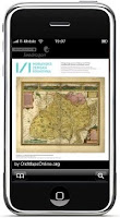
IIPImage is a light-weight client-server system for fast and efficient online viewing and zooming of ultra high-resolution images. It is designed to be bandwidth and memory efficient and usable over a slow Internet connection even on gigapixel sized images.
It is available for free, under an open source license (GNU GPL). We recommend installing
the software on a Linux (or other UNIX) server. We have prepared an easy to install binary package for Debian and Ubuntu with step-by-step instructions for installation.

JPEG2000 support has been implemented using the Kakadu library, which provides one of the fastest implementations of the JPEG2000 ISO standard and is redistributable for non-commercial use.

The enhancement of IIPImage was developed by the Moravian Library and the OldMapsOnline.org project with the support of grants from the Ministry of Culture of the Czech Republic.

The Moravian Library (http://www.mzk.cz/), based in Brno, Czech Republic, is a research institution and a legal deposit library. Project OldMapsOnline.org (http://www.oldmapsonline.org/) is a research project of the Moravian Library that aims to develop software to assist in the management, manipulation and visualisation of historical map collections on the web. The project team is designing online tools for publishing, collaborative georeferencing, annotation, 3D visualisation, accuracy analysis and geometadata specification for old maps.

For more information and for the IIPImage JPEG2000 software, see http://help.oldmapsonline.org/jpeg2000/.